
Finding Washtenaw Residents by Street
A street directory is strongest when it follows a consistent address trail. The county parcel search can return a property address, parcel number, taxpayer name, taxpayer mailing address, municipality, legal description, assessment data, and sales-history references. That creates an ownership and land-record lead, not a list of everyone inside a home. MapWashtenaw then provides parcel geometry and aerial context. The deed index can link the current parcel record to a recorded transaction, while a dated criss-cross directory can show an earlier household head at the address.
Michigan’s regular voter-status route is not a browse-all-voters-on-a-street tool. A geographic QVF request can be scoped to places such as a jurisdiction or precinct, but it remains subject to redaction and Address Confidentiality Program withholding. Keep the parcel, date, municipality, and source role beside each result. That small evidence log prevents a mailing-address result from being presented as current occupancy.
- Search the address or a street-number range in the County Property/Parcel Lookup.
- Record the PIN, municipality, property situs, taxpayer mailing address, and legal description separately.
- Check the parcel in MapWashtenaw and identify the relevant street segment or adjoining lots.
- Use sales-history Liber/Page and party names as leads in the Register of Deeds index.
- For an older question, compare AADL directory, criss-cross, census, newspaper, and map evidence by date.
Washtenaw Street Directory Parcel Search
Washtenaw’s Property/Parcel Lookup lets a street researcher use a street name, street number, number range, municipality, taxpayer name, or PIN. The site directs users to enter the street name only, such as Main rather than Main St. Pair a range with the city, village, or township value so a common street is not mixed with a different jurisdiction. Taxpayer searching uses last name first. When a result opens, retain the assessment year because taxpayer and homestead information is dated.
| Field | How it helps a street search |
|---|---|
| Street Name | Search the street name without its type. |
| Street Number / Range | Target one parcel or a defined segment. |
| City/Village/Township | Use the county’s CVT selector to resolve jurisdiction. |
| Taxpayer Name | Last name first, as a taxpayer clue rather than occupant proof. |
| Parcel Number | Use the PIN to bridge parcels, maps, and deeds. |
The parcel-search form is illustrated below. Its range controls are useful for a manual review of a block.
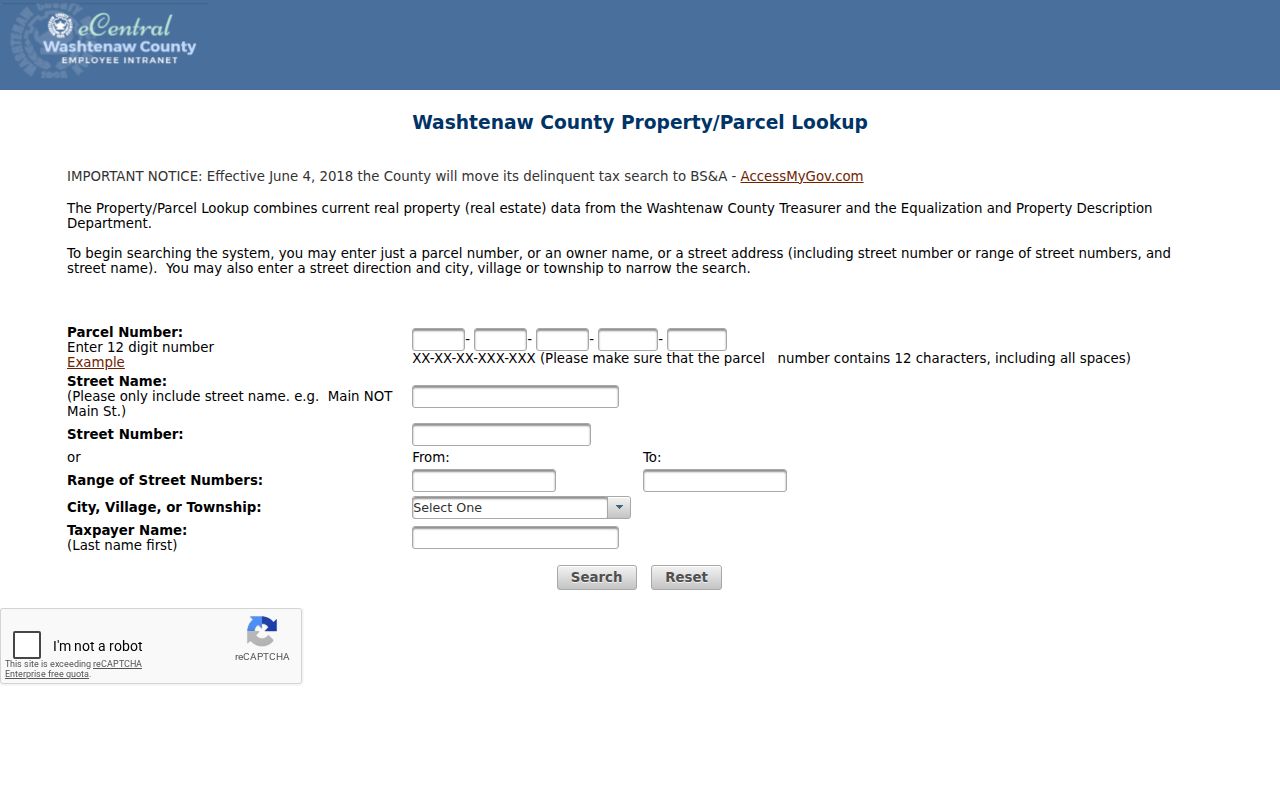
The search result is public property data, and the county directs users to local assessors for corrections or questions about supplied data.
Washtenaw Streets on MapWashtenaw
MapWashtenaw can be used after the parcel search to inspect parcel shapes, roads, aerial photographs, natural features, and topography. Click or query the relevant parcel, record its map date and PIN, and open nearby parcels individually rather than treating a broad map view as a roster. The county says GIS layers may contain spatial, registration, attribute, currency, completeness, projection, calculation, and representation errors. A map is not a legal description, survey, title opinion, or proof that a person currently lives there.
The official map launch page is shown below. Use it to connect address and parcel context, then confirm record claims with the appropriate custodian.
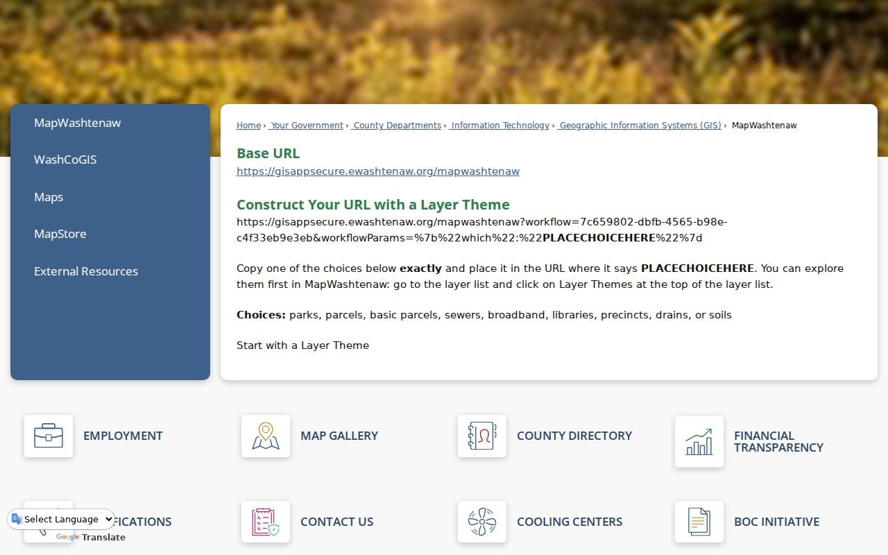
GIS gives a useful street picture, while recorded deeds and local assessor records supply the underlying administrative trail.
Washtenaw Street Directory Record Sets
Address-keyed sources answer different parts of a street question. The parcel roll handles the current tax and property relationship. The GIS viewer supplies spatial context. The Register index traces recorded transactions. Permit and inspection records can date work but do not automatically identify an owner or household. Historic directories and maps help reconstruct an earlier block. Treat each source as a separate dated statement, then compare its identifiers.
| Record Set | Keeper | What It Shows | Access |
|---|---|---|---|
| Parcel roll | County Equalization/Treasurer and local assessors | PIN, situs, taxpayer, CVT, legal description, sales history | Public current-data search |
| GIS parcel layer | Washtenaw GIS | Geometry, aerials, roads, and map overlays | Public viewer, not legal title |
| Recorded deed index | Clerk/Register of Deeds | Parties, instrument, Liber/Page, transfer lead | Public index; document-copy route |
| Permit and inspection file | County or local office | Well, septic, building, inspection, and soil-erosion clues | Search or request, field coverage varies |
| Historical reverse directory | AADL and Library of Michigan | Dated address-to-household-head or owner/renter clues | Online, print, microfilm, or staff help |
The PIN and legal description are the stable link between the parcel result and a deed chain. A street name is less stable, especially when an older directory uses a former name or numbering pattern.
Washtenaw Deeds Along a Street
The Register of Deeds public index is the next step once a parcel report supplies party names or a Liber/Page sales-history reference. Search spelling variants and preserve the portal’s document type, party names, recording date, Liber/Page, page count, and legal-description context. The index is a catalog lead, not the underlying instrument. Public indexed search is free; a login is required to purchase copies, and the office also provides a mail request route. The county documents land records from 1827, but its exact online-index cutoff was not located in official sources.
The public deed-index portal is pictured below. Use the result to request the document only after the reference and page count are confirmed.
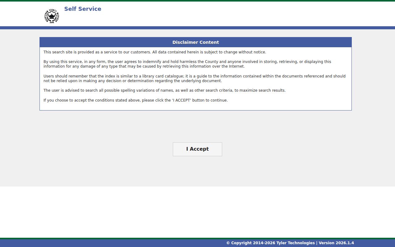
The Register’s stated mail-copy route is $1 per page and $5 for certification per document, with payment and a self-addressed stamped envelope required.
Washtenaw Street Names Through Time
Old directory hits must be translated before they are joined to a present parcel. AADL’s Lost Street Names of Ann Arbor records that John Allen’s 1824 plat used First through Fifth Streets, Main had a Third Street alternate, and the Old West Side used mirrored numbering in William Maynard’s 1840s layout. Fourth and Fifth were later redesignated avenues, and Seventh absorbed Jewett and Mann in 1891. A street number alone can therefore point to the wrong location if the edition and numbering system are ignored.
AADL’s historical street-name article is shown below. Pair a former address with a plat, Sanborn sheet, directory edition, and legal description before treating it as the same parcel.
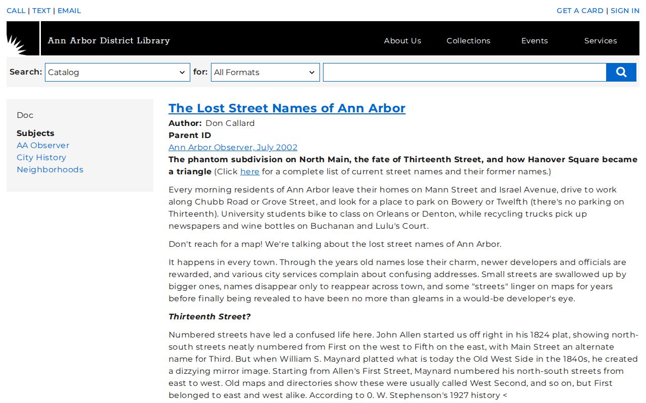
Ann Arbor’s ordinance also assigns street-name changes to City Council resolutions and premises-number assignment to the Department of Building.
Washtenaw Criss-Cross Street Evidence
Historic reverse, or criss-cross, directories are designed for the address angle. The Library of Michigan explains that Bresser-style volumes can list a street and house number with the head of household, telephone, owner/renter status, first-listed year, and new-arrival or relocation indicators. Polk volumes can reach to the late nineteenth century, and Bresser is commonly found from the late 1960s onward. AADL’s local materials and the Library of Michigan’s Washtenaw guide provide the practical fallback when a modern parcel portal cannot answer a past household question.
- Parcel
- A defined piece of land identified in the tax and map system.
- Situs address
- The physical property location, distinct from a taxpayer mailing address.
- Plat
- A recorded subdivision map that helps connect lots and legal descriptions.
- Criss-cross directory
- A reverse directory arranged by street and number rather than only surname.
Washtenaw Street Directory Permit Trails
County permit information links Citizen Self Service, permit-record searching, and flood-map material. County OnBase routes can involve well, septic, building, inspection, and soil-erosion records keyed to an address. The county’s practical search advice is to enter only the street number, then refine the result as available. A permit may date construction, an addition, or site work and can identify an applicant or owner, but it is not proof that the named person lived at the property. Historical coverage, full field lists, and copy fees were not located in the official research.
When an online result is incomplete, direct a focused request to the county or local permit custodian. Include the exact address, municipality, approximate date range, and record type, and ask for non-exempt portions if needed.
Washtenaw Street Directory Postal Checks
Before combining a property result with a street directory entry, verify the complete delivery address with USPS. A ZIP or postal city name does not replace the county parcel’s city/village/township value. For older work, pair the current postal check with the directory edition, historic map, and the printed number and direction. This extra step is especially useful where a street segment, former street name, or rural-route identity could otherwise put a household in the wrong location.
Limits of a Washtenaw Street Directory
A street directory cannot reliably list every resident, renter, visitor, or household member. The parcel roll is about property and taxes; it does not prove who occupies a unit. A voter record is governed by state privacy rules and is not an open street-browsing interface. Utility customer lists and protected motor-vehicle data should not be assumed public. A directory entry is historical, a map is spatial context, and a deed identifies a recorded land transaction. Keep those distinctions visible when researching a block.
A complete address also needs a postal check. USPS ZIP Code Lookup is the delivery-point authority, while the parcel result’s city/village/township value identifies tax jurisdiction. Those labels may not agree, particularly around township edges or a PO Box identity. Record the street number, direction, street type, postal city, ZIP, CVT, PIN, and lookup date. This prevents a street result from being shifted to a different municipality simply because the mailing city looks familiar.
When the online trail stops, use the fallback channels documented by the county and libraries. The Register index can lead to a mailed copy request. A permit or inspection question belongs with the County request or local office route. A historical address can move to AADL’s directories, Sanborn microfilm, newspapers, and staff-assisted archive material. Michigan FOIA, MCL 15.231 et seq., can seek existing non-exempt county records from the responsible custodian, but it does not require a court or agency to create a street list or disclose protected data.
For a whole-street project, keep one row per returned parcel and include the exact query, municipality, PIN, situs, taxpayer, mailing field, legal description, sales-history reference, GIS link, source date, and access limitation. That simple log makes the street directory research reviewable and keeps an inference from becoming a claim.
Check the official county, state, court, library, or USPS domain again before paying a fee or sending identification. Portal labels and access rules can change.
Lawful use. Use Washtenaw street and address records for personal, lawful research. Do not use a result to stalk, harass, intimidate, or harm anyone.