
Washtenaw ZIP Codes and Postal Areas
Washtenaw’s primary postal places include Ann Arbor, Chelsea, Dexter, Manchester, Milan, Saline, Whitmore Lake, Willis, and Ypsilanti. The county research found no single official ZIP-by-county master table, so each edge address needs a complete-address USPS check. The table groups common local postal identities and flags the places where ZIP and municipal boundaries can diverge.
| ZIP Code | Areas Covered | Post Office | Notes |
|---|---|---|---|
| 48103, 48104, 48105, 48108 | Ann Arbor and nearby township addresses | Ann Arbor | Confirm parcel CVT at the edges. |
| 48109 | University of Michigan campus-associated identity | Ann Arbor | Institutional postal identity, not a resident roster. |
| 48106, 48107, 48113 | Ann Arbor post-office identities | Ann Arbor | PO Box use does not establish property situs. |
| 48118, 48130, 48158, 48176 | Chelsea, Dexter, Manchester, and Saline areas | Local postal identity | Township or village context may differ. |
| 48160, 48189, 48191, 48197, 48198 | Milan, Whitmore Lake, Willis, and Ypsilanti areas | Local postal identity | Use full address and parcel check. |
Gregory, Northville, Pinckney, Plymouth, Salem, South Lyon, Stockbridge, Britton, Clinton, and Grass Lake include edge or overlap identities in the research inventory. Never assign a county or municipality from the ZIP alone.
Washtenaw ZIP Code USPS Verification
USPS ZIP Code Lookup is the final delivery-point check. Enter the complete street number, directional prefix or suffix, street type, postal city, state, and ZIP as returned. City-and-state browsing can help with a general search, but it is not enough for an edge address or PO Box. Preserve the exact input and result date. A USPS result establishes delivery context, not ownership, voter status, current occupancy, or the parcel’s legal municipality.
| Lookup input | Use |
|---|---|
| Complete address | Best choice for a delivery-point ZIP verification. |
| City and state | General postal reference, not a parcel decision. |
| Parcel CVT | Use the county result to resolve tax jurisdiction. |
| Map point | Check spatial context, not legal title. |
The official USPS lookup is shown below. It should be checked before an address is grouped with a ZIP-based research set.
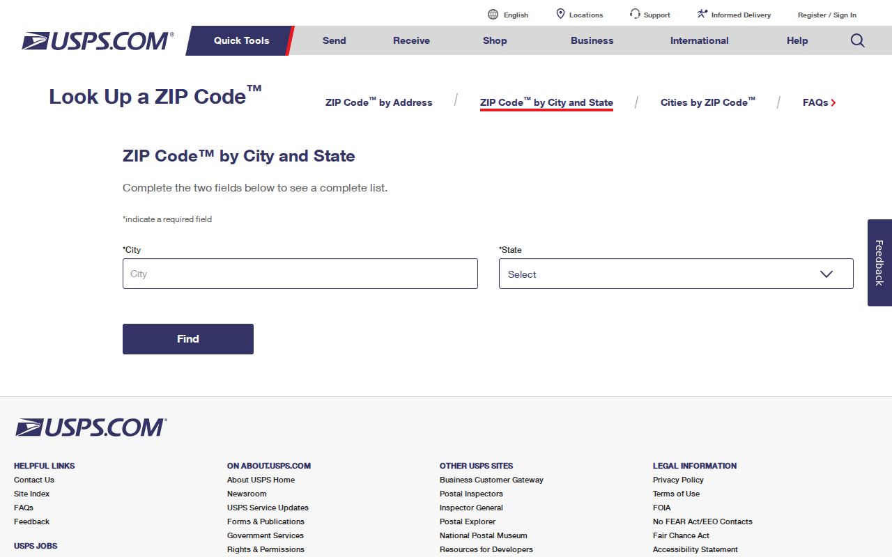
Its delivery answer is more precise than a state boundary map or a city-name assumption.
Washtenaw ZIP Code Boundary Mismatches
Postal city and legal municipality frequently diverge in Washtenaw. The parcel report identifies the city, village, or township tax context, while USPS identifies delivery context. A property’s situs address may differ from a taxpayer mailing address, and both may differ from the city name used in a historical directory. ZIP 48109 is an institution-associated Ann Arbor identity, while several Ann Arbor numbers are PO Box identities. Milan, Northville, Pinckney, Plymouth, and small edge ZIPs need particular care because a postal label can cross county or municipal lines.
MapWashtenaw and the parcel report are the county tools to use after USPS. A postal boundary visualization is helpful context, but the research identifies USPS as the address-level authority.
Finding Washtenaw Records by ZIP Code
The County Property/Parcel Lookup does not offer a ZIP-wide primary filter. Instead, search a street, number or range, taxpayer, parcel number, and city/village/township, then read the returned property ZIP with the CVT and legal-description fields. MapWashtenaw uses parcel geometry and layers rather than a county resident roll. Michigan’s voter-status route is a person and status tool; a QVF FOIA request can target a defined county, jurisdiction, district, ward, or precinct geography, with protected fields redacted. None of these is a complete ZIP resident list.
- Verify the complete address in USPS and save the result date.
- Search the County Property/Parcel Lookup by street, range, and municipality.
- Compare property ZIP, CVT, PIN, and MapWashtenaw point rather than relying on one label.
- For election research, use the current MVIC route or a properly scoped QVF request, observing all redactions.
Once a ZIP question narrows to a street and number range, the Washtenaw street directory has the parcel and deed sequence for address-level work.
Washtenaw ZIP Code Research Fields
Keep a four-part record for every ZIP-based result: the complete USPS address, the parcel CVT or municipality, the PIN or legal description, and the lookup date. Add a historic directory edition or map year when the question is older. This is especially important for rural-route and postal-era names, where a post-office name may not align with a township boundary. Ann Arbor’s numbered-street material also shows that a street can have segmented and odd/even address patterns, so a ZIP alone is never the whole geographic key.
- ZIP Code
- A postal sorting area, not a legal city boundary.
- ZIP+4
- An added delivery segment that refines the five-digit ZIP.
- PO Box ZIP
- A postal identity for boxes, not evidence of property situs.
- Carrier route
- A postal delivery grouping that does not establish ownership or residence.
Washtenaw ZIP Code Map Caution
The Michigan ZIP boundary map is useful visual context, but it is not an address-assignment authority. The research directs readers back to USPS for the complete-address answer. MapWashtenaw can show the parcel in relation to roads and municipal context, but the county warns that its GIS layers may have spatial, currency, attribute, and representation limitations. Use a boundary image to frame a question, then preserve the exact USPS result and county parcel CVT before describing an address.
Washtenaw ZIP Code Search Modes
Each public system accepts different geographic inputs. The parcel portal accepts a parcel number, taxpayer name, street name, street number, range, and city/village/township, then returns a property ZIP. MapWashtenaw works from parcel geometry and layers. Ann Arbor open data can search by address, owner, or PIN. Michigan’s voter route is a status tool, while a QVF request uses defined government geographies such as county, jurisdiction, ward, precinct, or district. Treat the returned ZIP as one field among those systems, not as a universal search key.
Washtenaw ZIP Codes Versus City Limits
A Washtenaw ZIP code directory must keep postal and governmental geography separate. The county has six incorporated cities, multiple villages, and many townships. Ann Arbor, Chelsea, Dexter, Manchester, Milan, Saline, Whitmore Lake, Willis, and Ypsilanti are familiar postal identities, but their delivery areas can include nearby township or edge addresses. An edge address should be checked against USPS, the county parcel property address and CVT, and MapWashtenaw before it is described as being in a city or county.
Several ZIP situations deserve a special note. Ann Arbor 48106, 48107, and 48113 are post-office or PO Box identities, and 48109 is associated with the University of Michigan campus. Chelsea 48118, Dexter 48130, Manchester 48158, Milan 48160, Saline 48176, Whitmore Lake 48189, Willis 48191, and Ypsilanti 48197 and 48198 serve their surrounding areas as well as their familiar postal names. Gregory, Northville, Pinckney, Plymouth, South Lyon, Stockbridge, Britton, Clinton, and Grass Lake have edge or overlap entries in the county research inventory. None should be assigned a county status from a ZIP alone.
Historic ZIP research needs its own date check. Pair the current USPS result with a directory edition, newspaper date, atlas, or map from the period in question. The research did not locate official Washtenaw ZIP split or realignment years, so do not invent a boundary history. Ann Arbor street segments and former names further complicate a street-address query. The property PIN and legal description remain the more stable bridge when a postal label changes.
For a postal question with no online answer, the fallback sequence is the USPS complete-address lookup, the County Property/Parcel Lookup, MapWashtenaw, and the relevant municipal or county custodian. Keep the source hierarchy in that order: delivery-point result first, parcel CVT and property ZIP second, map boundary context third, and historic directory evidence only for its stated date.
Michigan voter material and court indexes use their own jurisdictions and case boundaries, not a universal ZIP filter. For a record request, name the office, record series, relevant municipality or precinct, date range, and the exact address context. That approach respects the limits of a ZIP code directory while giving the custodian a practical way to identify a responsive public record.
Save both the postal result and the parcel result. They describe different forms of geography and can legitimately differ.
- ZIP versus ZIP+4
- The five-digit area is broad; ZIP+4 refines mail delivery.
- PO Box ZIP
- A box-service identity that should not be converted into property location.
- Unique or campus identity
- A postal identity associated with an institution or organization, not a resident count.
- Parcel CVT
- The county’s city, village, or township value for property-tax jurisdiction.